The Municipality of Port Hope has announced that it is undertaking new floodplain mapping projects to better understand flood risks and increase resilience within the local community.
The project is funded in part through Natural Resources Canada’s Flood Hazard Identification and Mapping Program (FHIMP) and is being carried out in close partnership with the Ganaraska Region Conservation Authority (GRCA).
What is Floodplain Mapping?
Floodplain mapping is the process of identifying areas of land that are likely to flood when rivers, lakes, or oceans overflow.
What is a floodplain?
A floodplain is the flat land next to a river or stream that can get covered with water during heavy rain or snowmelt. These areas naturally absorb and slow down floodwaters.
Floodplain maps help:
- Homeowners know if their property is at risk.
- Governments plan safer communities and emergency responses.
- Insurance companies decide who needs flood insurance.
- Builders and developers avoid building in risky areas.
Floodplain mapping can highlight:
Why are we doing this project?
The Municipality, in partnership with the Ganaraska Region Conservation Authority, is undertaking this floodplain mapping project for several reasons:
- Our current models for floodplains are 30 to 50 years old - they need to be current to reflect changes in land use.
- We need up-to-date models and mapping to inform the Official Plan and Zoning maps.
- Mapping and models provided to municipal partners, consultants, etc. help to quantify flood risks and test impacts of development
- The new maps will support future risk assessments for culvert and bridge infrastructure
- The project outcomes will be used to inform and prioritize municipal asset management plans
- The models will test climate change scenarios and make our communities more resilient
Project Information
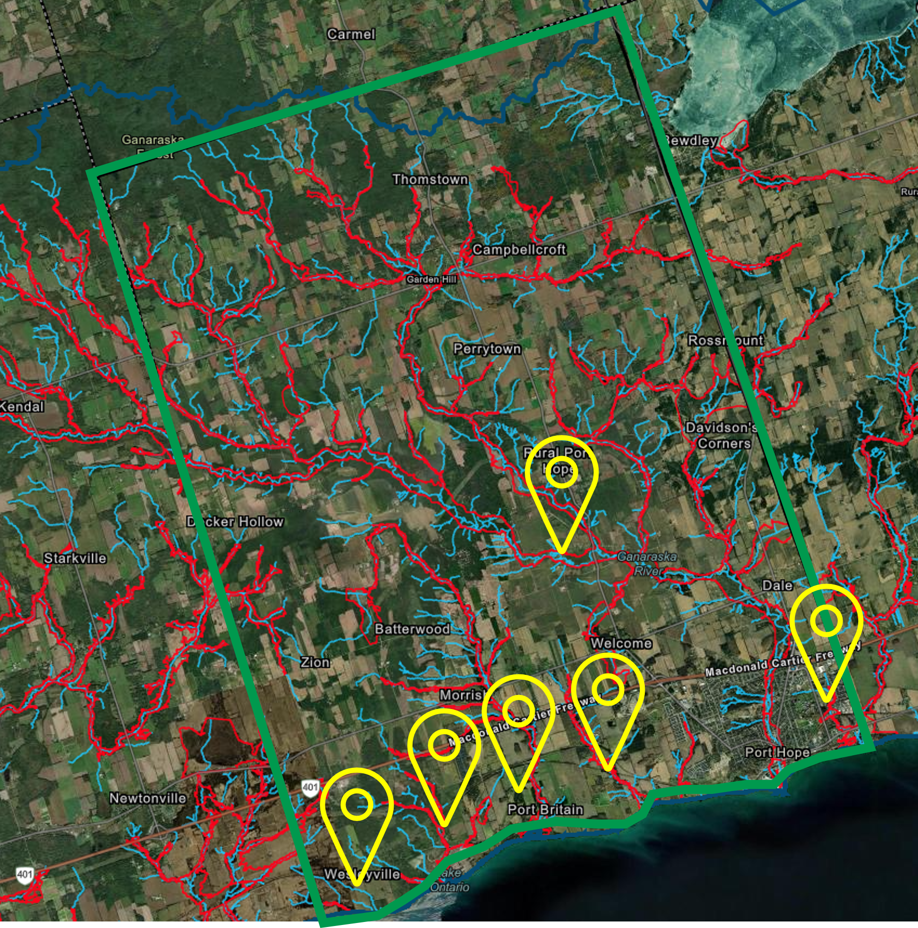
The project will update all historic floodplain models and mapping within the Municipality over 3 years
It will cover 6 watercourses including:
- Wesleyville Creek
- Port Britain Creek
- Brands Creek
- Little's Creek
- Ganaraska River
- West Gages Creek
This work will cover 246 kilometers of watercourse length, 272 square kilometers of drainage area, and 171 structures to be surveyed.
Test your knowledge about the Ganaraska River Flooding
Take this short quiz to test your knowledge about the flooding of the Ganaraska River. For more information on the answers to the questions, read the History of the Flooding of the Ganaraska River at grca.on.ca/about-grca/our-history/
Between 1848 and 1937, how many flood events were recorded by local residents and the media?
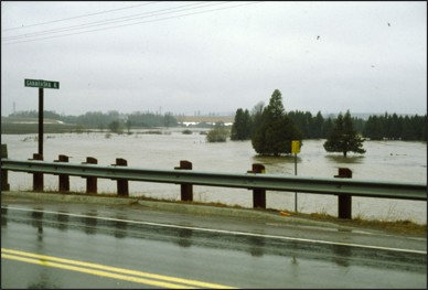
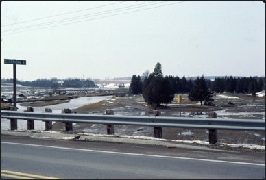
Throughout history the Ganaraska River has experienced flooding at varying degrees Between 1848 and 1937, 34 flood events were recorded by local residents and the media.
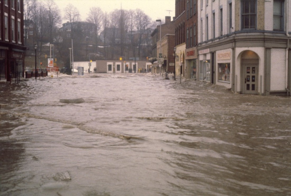
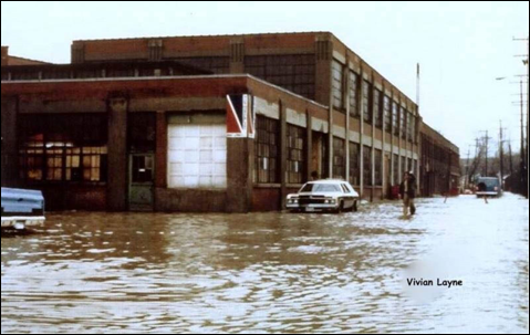
On March 21, 1980, the flood of the century hit the Ganaraska River. This event caused the Ganaraska River to experience a flow of 421 cubic metres/second, causing HOW MANY acres of downtown Port Hope to be flooded with water depths to 1.5 meters (m) and
This event caused the Ganaraska River to experience a flow of 421 cubic metres/second, causing 66 acres of downtown Port Hope to be flooded with water depths to 1.5 meters (m) and velocities sufficient to knock down building walls.
To mitigate further flood events like what was experienced in 1980, channelization of the river through downtown Port Hope was proposed and constructed. The river was widened and deepened over approximately HOW MANY metres to allow greater capacity of flo
To mitigate further flood events like what was experienced in 1980, channelization of the river through downtown Port Hope was proposed and constructed. The river was widened and deepened over approximately 1,000 metres to allow greater capacity of flow to move through the town.


